The polis of Lousoi on the Peloponnese provides the opportunity to examine numerous aspects of an ancient Greek urban culture from the point of view of a small but rich in traditions and supra-regionally well-connected settlement. An interdisciplinary research project is focused on key questions regarding the expansion and the development structure of Lousoi as well as the functional organization and urban spatial development of the public center of the polis.
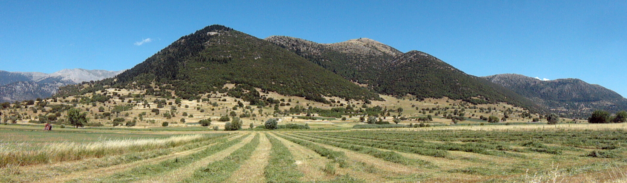
The ancient town of Lousoi in the northern Peloponnese is located on the south-eastern edge of the fertile high plateau of Sudena surrounded by mountainsides. Located in the border region between the ancient landscapes of Achaia and Arcadia, the city was of regional significance already fairly early due to the existence of the cult of Artemis Hemera since the Geometric period. The study of the sanctuary and the settlement began in 1898/1899 and has continued since 1980 by the Athens branch of the OeAI. It has shown that the material culture of ancient Lousoi had in many ways remarkable local peculiarities. At the same time, the development of the city was shaped significantly through its inclusion in regional and supra-regional communication and transaction networks.
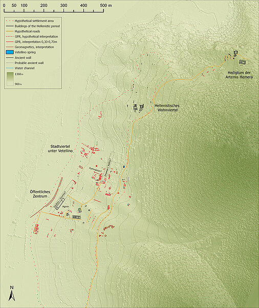
The town limits of Lousoi were not built over after antiquity and due to its limited size of about 20-40 ha it is ideally suited for a systematic analysis of the entire settlement structure. In 2015–2017, the creation of a topographical map of the settlement, a high-resolution orthophotomap, and a large-scale architectural survey led to initial fundamental insights on urban connections. In the area of the public center as well as in its immediate vicinity a pilot study was carried out in order to test the suitability of different geophysical survey methods for the large-scale documentation of subsoil building remains in the urban area. At the same time in 2017 excavations in the city center were resumed which from 2000 to 2012 had led to important insights on the urban development from the Geometric to early Imperial period.
In relation to the spatial structure of the city and the archaeologically tangible buildings of Hellenistic Lousoi, a survey of the underlying evidence reveals a remarkable tension between the reception of supra-regionally widespread urban planning concepts and construction on the one hand and the consideration of specific local parameters on the other hand. The internal structure of the city as well as its limits were largely defined by natural conditions. The elongated city area is marked by a rugged terrain, small watercourses, and marshy zones in the plateau. The construction ends close to a deep gorge and on its northern opposite site the peri-urban sanctuary of Artemis Hemera is located. Starting at the sanctuary, a historic route appears to run along the upper edge of the settlement and it might have had an important function in the development of the individual settlement areas. In the northern city area the development of the very uneven terrain took place in small terraces that followed the natural topography and primarily appear to have provided space for residential constructions, as illustrated by two exposed Hellenistic houses. To the south, the terrain flattens off and permits the construction of expansive construction terraces which were also used for public buildings.
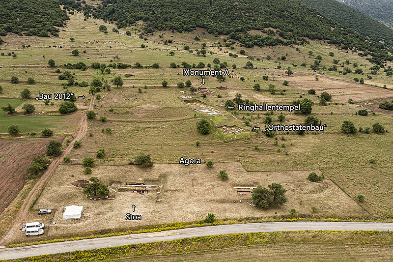
For the area referred to as Stadio close to the karst plateau the previous research already has provided comprehensive findings on the monumental development of the Hellenistic polis with political and religious buildings as well as the diachronic dynamics in the urban development. A two-aisled stoa, a sanctuary consisting of a peripteros and a small oikos, various smaller monuments as well as other unexcavated large buildings built across several terraces stepped above each other are evidence of contemporary urbanity but also reveal strong locally influenced constructions. Against this background, the new research on the spatial and functional organization of the public center is another important key to a deeper understanding of the urban structure and development of Lousoi.
Funding 2016–2018
Funding 2019–2022
