The unit "Technology" constitutes an important integrative element of the Institute. The capturing, processing and presentation of geodata and data of archaeological finds, as well as the graphic documentation by means of digital photography, play a fundamental role in the scientific synthesis of nearly every project of the ÖAI. The Technology unit is composed of the four working areas of archaeo-survey, geodesy, excavation technology and photography. A maximum level of innovative creativity, quality and efficiency in the implementation of ideas and development of methods is achieved due to interdisciplinary cooperation.
Contact
oeai-technik(at)oeaw.ac.at
Archaeo-survey

The areas of competence of geophysics, geosurvey and geoarchaeology are subsumed under the term archaeo-survey. The planning and implementation of geophysical surveying and geoarchaeological investigations are transacted in this area of the Technology unit. By means of the most up-to-date geophysical surveying equipment (geomagnetic and georadar), underground objects and structures are made visible. Deep-core drilling provides information regarding stratigraphic sequences and deep-lying structures.
The main duties of this working unit are the processing of the measurement data with the aid of the most current processing methods, and the subsequent cartographic realisation of the data obtained. To this end GIS software, including the archaeological interpretation of the measurement data, is applied. The Technology unit is also responsible for the continual maintenance and further updating of the inventory of equipment, according to the respective state of technological development.
Contact
Franziska Reiner
Geodesy
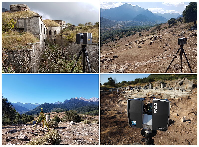
This working section covers an important central function for the geospatial aspects of archaeological research, combining comprehensive competence from the areas of surveying and geoinformation. The central duties include the imparting of fundamental geodetic concepts and methods as well as consultation in the implementation of geodetic instruments, geographic information systems (GIS) and the most up-to-date 3-D sensors. The high visual quality of research results is guaranteed via the professional creation of plans and maps, following the principles of cartography.
The creation and maintenance of precise geodetic networks, the carrying out of specialised measurements with a variety of 3-D sensors, as well as the exact capturing of archaeological-historical objects and their topographical context constitute the focus of activities at excavations or archaeological surveys. The recording methods thereby applied are basically determined by the demands of the particular problems and issues, which are submitted to a subject-specific analysis.
Contact
Brigitte Danthine
Photography
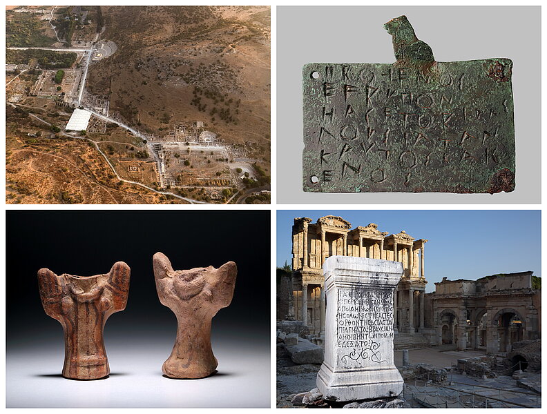
In the working area of Photography, images of the entire spectrum of archaeological finds, including large-scale excavation documentation, macro- and panorama photographs as well as architectural photographs are produced. Via the application of the computer-based photographic process (Reflectance Transformation Imaging – RTI) with the fully automatic RTI-Dome, developed in the framework of a Citizen-Science-Project by the ÖAI in collaboration with the HTL St. Pölten, surface structures of selected objects can be re-illuminated in an interactive analysis. The photographic department's portfolio is completed with images for sponsors, presentations and press releases in connection with technologies such as UV- and IR-photography, as well as RTI.
In order to guarantee the visualisation of archaeological artefacts, finds and monuments, high-definition, distortion-free and colour-fidelity work is essential. In addition to its documentary character, photography also supports argumentation and theories.
Contact
Niki Gail
Excavation technique and documentation of finds
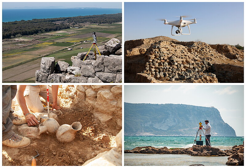
From the first inspection of an archaeological site up to its publication – the employees of the working area 'Excavation Technique' support the archaeological fieldwork projects of the ÖAI in their planning, implementation and evaluation.
In order to guarantee the generation of high-quality research data, innovative and sustainable solutions for the recording of archaeological finds and evidence are applied and further developed. For these duties, the employees of the working area use their established knowledge in the application of efficient methods for surveying, excavation and documentation, with the aim of implementing high technical and scientific standards.
From hand measurements up to 3D photogrammetry, from the investigation of data up to its visualisation – the goal is to react adequately and in a solution-oriented manner to the individual requirements of the respective research projects.
Contact
Mario Börner