The 3D team focuses on 3D-related technical projects.

The investigations in the Pamphylian city of Side, which have been ongoing since 2015, focus on several thematic areas: The individual buildings of the episcopal complex of the basilica-residence ensemble are being examined, primarily with regard to their construction history (dating, period of use, building typology, etc.) and their function. Furthermore, the question of whether there is a structural and functional connection with the area adjacent to the ensemble to the west is being investigated. Given the size and diverse development, this would constitute an episcopal quarter. To support these investigations, a virtual city model is being created based on the point cloud created using SFM (structure from motion) and classical surveying methods. This model incorporates all representative buildings, as well as ancillary buildings and other spatial architectural elements. A key focus is also placed on questions of urban integration within the entire early and middle Byzantine urban fabric and the sacred topography.

The virtual reconstruction of the Theban Monastery of St. Paulos in Deir el-Bakhît is carried out using a point cloud of the excavations created with Structure from Motion and the respective building surveys as a starting point. During the reconstruction, 3D models of the building volumes are created and combined into an overall model. The availability of sketches and descriptions from the 19th century, when the monastery ruins were less dilapidated, facilitates certain aspects of the modeling and provides answers to questions such as the building heights of certain parts of the monastery, the number of floors, and the placement of windows. Analogies to existing architecture can sometimes be used. Where possible, various phases of the monastery's construction history are also presented.

In the virtual reconstruction of the Magnesian Gate in Ephesos, special attention was paid to depicting the various construction phases, including the deterioration of the complex. The existing structure is marked by a red line. Better-preserved structures were used as a comparison to help determine the height of the gate tower. A total of eight construction phase models were created.
Project in preparation for publication

The extensive ruins of Alinda were systematically recorded between 2007 and 2011 using non-destructive prospecting and documentation methods as part of a surface survey. The objectives of the project were the consistent recording and periodization of the preserved structures, as well as the analysis of the urban development and transformation of the settlement up to the Byzantine period. In addition to a digital reconstruction of the entire city, more detailed 3D models of sub-areas were also created. The focus here is on the citadel, the temple precinct, and the agora. The citadel was reconstructed in 3D both during its Hellenistic phase and during its later conversion into a fortified settlement in the Byzantine period. The results are currently being prepared for publication.
Project in preparation for publication
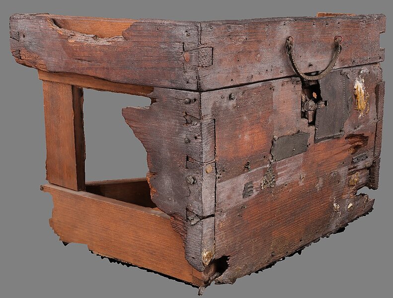
The project, which began in 2023, focuses on the late Roman caskets from the upper Danube provinces, investigating their origin and historical context, whilst analysing their iconographic visual patterns and the production techniques employed in Late Antiquity. Before the starting of the project, some capturing tests were made to clarify the methodology to use for the data acquisition: 3D Laser Scanner with FaroArm Scanner, Breuckman type of scanner or Photogrammetry. The later was selected was selected as method for the reliability, texture and mobility for the project. The processed 3D data is orientated to get a highly accurate 3D geometry ant texture of the current remains located in Hungary and Austria. Caskets of Late Antiquity project, will use them together with the research documentation to analyse and distinguish iconographic features, crafting marks, and possible workshop patterns for manufacturing techniques (metal and wood) to consider the use and possible reuse in different contexts. The 3D data will be the base of proposed 3D reconstructions of some of the best-preserved caskets, to show in form of animation developed by the 3D Team, the environment where they were used until they were discovered by researchers.
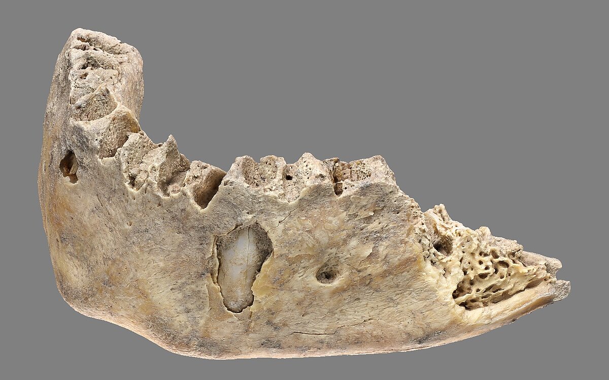
The work of the 3D Team in this project is a special request from the Anthropological lab of the OeAI to study in deep the morphology of some of the remains in this long-standing project of the ÖAI in Serbia (from 2018). The aim is to evaluate the geometry and texture delivered by Photogrammetry in contrast with the Computer Tomography (CT) Scans of the same remains. This small research project is meant to set a solid workflow for future endeavours when analysing human remains in the OeAI excavations. Following a previous test to evaluate the quality and the settings for the capture of the remains August 2025 (see image), the next step is to 3D capture the rest of the selected remains to pursue the biocultural analyses of this chrono-geographical context for the anthropological study of this Neolithic site. The acquisition of 3D models is also an important prerequisite for any subsequent invasive analysis, in accordance with international guidelines related to the preservation of archaeological remains for future generations. The 3D scan will be the only 1:1 copy that shows it original preservation and, in both geometry, and texture.